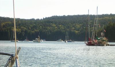
 Port McNeill. (click here for larger image)
 The log of S/V Lacuna, spring and summer 2005
Chapter 12
September 3 to 15, 2005. Port McNeill to Eugene.
Port McNeill. (click here for larger image)
9/3/05. A lay day at Port McNeill. I washed the interior surfaces of the cabin with peroxide and fresh water—they were turning gray with dust and mildew. I again cursed the dysfunctional kerosene space heater that we have. I have been unsuccessful almost every time I’ve tried to use it during the fifteen years we've owned it, and every attempt during this voyage has ended in frustration and failure.
Had Lacuna a functional heater, her interior could be dry even when away from shore power. Oh, well, it’s just another system to spend money on. But in the meantime, I’ll use high-temperature sealer in an attempt to stop the oil leak at the base of the burner. The oil tank must be pressurized to 15 pounds per square inch, and that should be enough to reveal any leak. But no…
The last time I tried to use it, just a few days ago, I pressurized it, let it sit for hours, found no trace of any leak. Pressurizing it is no trivial task—the tank holds a couple of gallons, and pumping that up with a small bike pump is difficult and time-consuming.
Then I ignited it—a scary process that involves filling a tray under the burner with alcohol, lighting that, and letting it preheat the oil burner. Just before the last of the alcohol goes up in flames, the theory goes, one opens the valve on the oil burner, now pre-heated to vaporize the oil, and a clean-burning, vigorous oil flame ensues. Just as it says in the owner’s manual, it worked. A robust oil-fed flame burned blue and hot.
I knew better than to issue premature congratulations. Within five minutes, I smelled unburned oil. With the flashlight, I looked below the base of the burner and found a leak out of a fitting. Curses! I turned it off, cracked open the pressure valve on the tank, and let the hard-won air pressure out. The only heat I got from it was the body heat I generated stroking the bike pump to pressurize the tank and the rising anger that I felt after the heater betrayed my efforts to make it useful. But dealing with frustrating and ill-designed equipment is part of life, certainly part of boating, and there’s a practical and meditative art to approaching problems with equanimity. So I’ll try again.
9/4/05. As I was prepping Lacuna for departure, a toothless geezer was setting up his crab traps on the finger slip we shared. He had scrounged some halibut heads and a dead sculpin and was tying them into the traps. As he tried to fit the two traps aboard his 18-foot skiff, on which not a single component was less than 20 years old, he complained about small boats. But he agreed with me, as one small-boat owner to another, that it was better to have a small boat than no boat at all.
On the VHF weather station, a warning came of a three- or four-mile long patch of driftwood in Finlayson Channel, the result of a landslide. It was just south of Cone Island near Klemtu, where I was just a few days ago. I’ve seen many landslide tracks on these steep, rocky mountainsides and have been wondering what the aftermath would be if one were to let loose—now I know. Big time hazards to navigation! I heard no report of any damage from tsunami-like waves.
After noon, I was approaching Robson Bight, famous for the frequency of orca sightings. It’s a protected reserve where the whales often go into the shallows for self-massages: they rub and roll on the bottom in the shallow water. I was on the lookout for orcas, but instead I saw a humpback spout and dive. Soon a lone orca swam by, its tall dorsal fin unmistakable. I watched the whale-tour boats to see where the animals were—if the boats are going slow, there’s probably one or more in sight. Sure enough, right by the boat landing and cabins where scientists stay when they come to study the orcas, there was a pod of three or four splashing through, the tour boats idling along behind.
I anchored in Billygoat Bay, in the middle of a reach of Johnstone Strait infamous for its currents. There were a couple of other boats already in the bay. I guess I’d better get used to sharing the anchorage now that I’m back in populated areas.
 Billygoat Bay. (click here for larger image)
During the day’s passage, I took the fuel supply line off the heater and applied high-temperature sealer to the joint. After waiting a few hours for it to set up, I pressurized the tank again, working up a sweat with the bike pump, and watched for leaks. None appeared so after a couple of hours of pressure checking I filled the pan with alcohol and pre-heated it. As the last of the alcohol burned away, I opened the oil valve and…nothing. No hiss, no flame, no oil. Disgusted, but expecting a result like this, I turned to other boat chores.
9/5/05. I had a long day planned today, one that required good timing. I wanted to pass through four major tidal rapids: Greene Point Rapids, Dent Rapids, Gillard Pass, and Yuculta Rapids. If I hit it just right, I’ll push against contrary (ebb) currents through Greene Point, hit the tide reversal just before Dent Rapids, then ride the rising tide through the last two, which are within a few miles of Dent Rapids.
A problem is that it’s more than 12 miles between Greene Point and Dent Rapids—that’s probably three hours if there’s any contrary current. I’ll be hitting adverse currents that are close to the maximum at Green Point if I’m to pass through them in time to get to slack at Dent. Another problem is that I’ll have to leave my anchorage 45 minutes before dawn—at 0600.
I got up when the alarm went off at 0500 and quickly set about rigging to run. I was motoring out of the bay by 0610 into fog and darkness. I had Lacuna’s running lights on and the chartplotter and radar showing me what was around me. Right away I hit a 1-knot contrary current and lots of swirls. Good morning!
As the morning waxed, the fog burned off, the sky opened up, and the threat of rain eased, but I kept my fleece and goretex on because it was still cold even though the sun was shining.
When I got close to Greene Point Rapids, I hugged the shore to get out of the worst current and found a helpful eddy that boosted Lacuna’s speed by a couple of knots while the waters in the channel were racing past. As I worked my way through the choke point, I watched the speed-over-ground display on the GPS. Sometimes it said 0.0 knots as OB, cranked up, strained against the current. Around me on both sides boils and whirlpools would open, sucking in water around them. With my eyes on the GPS, I found the threads of current that weren’t as contrary, and with my eyes on the water, I slalomed through the worst of the boils, Lacuna rocking and yawing as the current took her one way or the other. I got in the lee of the Cordero Islands and ducked between them before breaking free of the rips and into a wider channel with a less adverse current.
 Greene Point Rapids (click here for larger image)
I kept OB throttled up as I headed down Cordero Channel. My speed was a bit slower than I had planned on—the adverse current was a bit stronger than I had hoped for.
 Dent Rapids (click here for larger image)
I got to Dent Rapids about half an hour after slack, but this time the currents were favorable. I got a quick ride, with speed sometimes over 9 knots, zipped right through Gillard Passage and Yuculta Rapids, and was soon in well-named Calm Channel.

A modest summer cabin at Dent Rapids
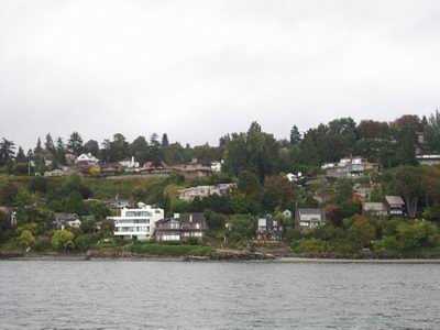
I was surprised by how many buildings there were in the reach from Dent Rapids to Yuculta Rapids. I remembered a resort and a few other buildings when I was here five years ago, but either my memory is suspect (always a possibility) or there’s been a lot of new construction. On the west bank a huge new complex is going up—a couple of multi-story buildings, numerous one-story buildings, walkways, boardwalks, gazebos, docks…the yellow tower crane and scaffolding show that’s still under construction. I was also disappointed by the number of clearcuts there are on all the hillsides along these channels. Wilderness it’s certainly not!
 Yuculta Rapids development

 Gillard Passage and Yuculta Rapids (click here for larger image)
After the rapids, the navigating was simple—the channels are long, straight, and deep, with few offshore hazards. A navigator has to keep in mind which channel is which, because there are many and it’s easy to get confused. Anchorages are sometimes hard to find, so it’s best to know in advance what the day’s destination is.
By 1620, I landed at the public dock in Squirrel Cove and walked to the store, only to find that it had closed early for Labour (sic) Day. I took a brief but brisk walk up a hill then returned to Lacuna and motored to the head of the cove, where I anchored in a little nook. At its head, a reversing tidal rapids ran into and out of a lagoon. It sounds like a mountain stream but it’s episodic, quiet at times and noisy at others.
There are 20 other yachts in the basin here. No more privacy! I’m so spoiled by having most anchorages to myself. Thank goodness it’s a quiet crowd. Near me, two boats are rafted together and there was a lot of laughter and loud talk from them before dark—but now, almost 2200, it’s nice and quiet. No one (bless them!) is running a generator or playing loud music.
Nature had a little lagniappe for me as soon as I shut OB off: crickets chirping on the nearby shore. I haven’t heard crickets except on a phone call earlier this week to Jill—I didn’t realize how much I enjoyed their song and how much I missed it until I overheard them during our conversation. With the madrone trees (“arbutus” in Canada) and the crickets, I feel as if I’m almost home.
The madrones are a welcome sight to a soggy mariner. They grow only in dry areas—here, in the rain shadow of Vancouver Island, and at home, in the rain shadow of the Coast Range. I can expect relief from the incessant showers and 110 percent cabin humidity that I’ve experienced in the past few weeks. I put up the boom tent only to dry it—as soon as the sun went down, I took it in so it wouldn’t get wet from the dew. My timing was a bit off—I got involved in phone conversations (great cell phone service here!) and took it in about 15 minutes too late—dew had just begun to settle. But it’s a lot drier that it was when I put it up—water ran out of the seams and dripped out of the lines when I unfolded it.
During the day, I took the burner and fuel line out of the heater and found that I had applied too much sealant—I had plugged the tiny orifice that meters the flow of oil into the burner. After I cleaned I it thoroughly, I reassembled it with a minimum amount of sealant, taking care not to let any near the orifice. After waiting for it to cure, I again pumped up the tank and filled the preheater pan with alcohol.
As soon as I lit the alcohol, it started leaking out of the pan. Burning alcohol dripped on the toilet plumbing below. That’s it! That’s all I can take! This piece of junk is history! I can recall only one day when this heater worked the way it was supposed to, only one day in fifteen years of carrying the worthless piece of shit here, there, and everywhere. Lacuna needs a functioning heater, one that can be used safely and conveniently. This is definitely not it.
9/6/05. The weather forecast looked good for another day of passage-making, so I got up at 0600 and was underway by 0705. I slalomed among the yachts packed into the cove—no signs of life yet—and navigated out through the narrows into a beautiful morning. The sun was just rising, the skies were clear except for low clouds in Desolation Sound, and the visibility was terrific.
 Clouds in Desolation Sound
At 0920, I pulled into Lund to see if I could get a quick shower. The guidebooks said that the town is trying to attract pleasure boaters. New showers, a nearby liquor store (liquor stores are the only places that sell beer in BC), and a grocery store were in the offing. But the all-too-small docks were full. I could have rafted alongside another boat, but it was more than I wanted to take on, so I turned around to resume my passage.
Lund bears further investigation as a place to launch a trailer-sailer—it’s the northerly terminus of Highway 101 and only a couple of hours from Desolation Sound, even in a slow boat. There’s long-term truck and trailer parking and dry storage for boats.
During the day’s passage, I admired the views of mountains on both sides. On Vancouver Island, many peaks still have extensive snowfields, which is amazing considering how low they are. To the east, big peaks tower over the skyline, some clothed with snowfields.

I passed Powell River, made ugly by a steam-emitting pulp mill and a basin surrounded by a breakwater made of scrap ships.
In the afternoon, a northwest wind rose, so I put up the sails for a downwind run. It takes at least 10 knots of wind to be useful for passage-making, and for a couple of hours Boreas was kind enough to oblige. For an hour, I was even able to maintain more than 5 knots with OB turned off, a rare occurrence in these waters. Unfortunately, it didn’t last, so I dropped the sails and resumed motoring. The day was so warm that I took a sponge bath and washed my hair.
I pulled into Smugglers Cove and threaded all the way back to the inner basin, where I set anchor sharing the basin with one boat. I was hoping for privacy but an inflatable dinghy revved through, two people egging on a Jack Russell terrier perched on the bow, getting him to bark at a couple of Canada geese that were paddling hard to evade them. I miss the solitude of Alaska!
 Smugglers Cove, inner basin
9/7/05. Last night I didn’t get the bug screen up in time to prevent a few mosquitoes from stowing away. Unlike the pesky blackflies and no-see-ums, mosquitoes will attack at night, and in my slumbers I was awakened more than once by the whine of little wings hovering around my flesh. I tried to slap where I thought they were, judging by the sound and the feel of the wind from their wings on my face, and finally, after my many futile attempts to crush them, they stopped bothering me.
I woke up before dawn and headed out to make passage as soon as I could see to work my way among the anchored yachts. The outer basin had eight or ten boats close by each other, anchored at the bows and tied to the shore at the sterns. I was glad that Lacuna was small enough to fit back into the little nook where big boats don’t dare go—I had plenty of privacy, comparatively speaking.
Crossing the Strait of Georgia to Nanaimo was uneventful except that the weak NW wind set up chop that caught Lacuna beam-on. That started an uncomfortable roll, so I headed higher to take the waves at a better angle. The breeze rose enough that I set sail. For the rest of the passage, except for an hour when the wind alone was enough to keep Lacuna above five knots, I kept OB running to keep the speed up. I had a date with a slack at Dodd Narrows that I didn’t want to miss, and I wanted to stop in Nanaimo to get gas and a shower.

Nanaimo skyline
I got gas, moved to a short-stay dock, and hustled to the chandlery to buy an essential supply: toilet holding tank deodorizer. After taking a quick shower at the harbormaster’s office, I cast off and cranked the throttle up because I was about half an hour late. Fortunately, I caught favorable currents all the way to the entry of Dodd Narrows and slipped through with only a one-knot adverse current for the hundred yards of the narrows. From then on, it was easy motoring through the channels of the Gulf Islands. There was little breeze and no waves. Quite a few sailboats were out chasing the fickle wind. I passed up a couple of crowded harbors and anchored alone in the little cove at Panther Point, the south end of Wallace Island.
 Nanaimo and Dodd Narrows (click here for larger image)
9/8/05. I had planned to set off at 0900 to catch favorable currents, but I got a late start because I realized that not all the charts I needed were at hand. Before this journey, we had always rolled the charts and stored them in tubes. When stored, they were compact but not very accessible. On our Vancouver Island circumnavigation, Ed and I got a lot of experience unrolling and re-rolling charts. When we used them, we folded them in half, face out, and wrapped them around a piece of light plywood cut to fit. It was the biggest navigation table that we could fit on Lacuna. When not in use, it conveniently slid under the vee-berth, out of the way. But in use, it occupied most of the cabin.
Rolling the charts tightly enough to fit in the tubes was sometimes difficult, but the most difficult part was wrestling with them once we separated them from their tightly-rolled brethren. Paper has a memory that is not easily overcome. The struggle was worth it, we figured, because we could draw course lines for route planning and record ded-reckoning positions while sailing if we had a wide, flat surface to work with. Even though we had two GPSs on board, we stuck with the traditional way of recording passage by marking locations, times, and speeds on the chart.
In the five years since, I’ve gained confidence in my trusty GPS. It’s been through a lot and has not only survived but given me amazingly accurate information. Now I’m sure that I’ll be able to call for help, should I need it, with Lacuna’s exact coordinates instead of having to look at the chart and say, “I think I’m about a mile and a half north by northwest from Alki Point.” As a result, I use the charts much more for orientation than for record-keeping. And I use them all the time.
I always have the chart unfolded in the cabin for immediate review. I follow it closely as I make passage. If I don’t have a large-scale (large detail, small area) chart of the area I’m navigating, I get nervous. Over the years, we’ve scrimped on charts, relying on small-scale (small detail, large area) atlases, but I’m through with that. I’m disappointed with electronic vector charts. The ones that I have (C-Map) omit land detail completely, an omission that I find intolerable. As a result of my affection for and dependence on charts and guidebooks, Lacuna is carrying at least a hundred pounds of paper, if all the charts, tide tables, and cruising guides were weighed together.
Last year, I bought a set of used charts for the Inside Passage. They were folded instead of rolled, and were so much easier to use that I decided that all Lacuna’s charts should be folded. But here I was, emptying the most tightly packed of the map tubes in Lacuna’s chart inventory, wrestling with recalcitrant paper that seemed to have a perverse will of its own, trying to fold rolled charts into eighths. It took longer than I expected, but I didn’t want to have to unroll one in transit and try to make use of it—I figured I’d better just take care of them all at once.
It was the cornucopia of charts. Just when I thought I was down to the last two or three, half a dozen more emerged from the roll. I wound them backwards around the tube, hoping to counter the memory. That helped, but they still were loathe to cooperate. By the time I wrestled the last one into reluctant submission and filed it in sequence in the chart case, an hour had passed.
It was a beautiful morning and I had the little cove all to myself, so I wasn’t eager to leave. In many ways, it reminded me of Snoring Bay on Sucia Island, one of my favorite anchorages—it’s small, narrows to a beach, and is surrounded by low sandstone cliffs draped with madrone trees. But tides and time wait for no mariner, and I had to leave.
I crossed into U.S. territory in the early afternoon and motored across big water to Friday Harbor, where I checked in with customs. Nobody came to inspect me or my boat; it was all done by phone and video camera at the dock. When I picked up the phone, it automatically dialed the Customs office. The agent who answered could see the dock, because she asked if I was aboard the small sailboat tied there. She asked for my passport number, name and address, and had me stand in front of a video camera while I held my passport in a slot that was equipped with another camera.
At her request, I removed my hat and sunglasses. She commented that my hair grew fast—it wasn’t that long since the photo on my passport was taken. After asking about how much liquor I was bringing back and whether I had read the list of prohibited fruit, she gave me a clearance number and sent me on my way. I tied Lacuna up in the Friday Harbor marina along a busy walkway then set out for food, drink, and a shower.
 Lacuna at Friday Harbor
9/9/05. I left Friday Harbor at 0740, facing rain showers and possible thunderstorms. The news announcers on KPLU (one of the best radio stations anywhere) commented on how rare thunderstorms are in this area. Sailing on a small boat equipped with a 28-foot lightning rod, I can do without them.
As I crossed the Strait of Juan de Fuca, I raised the sails and kept OB running, motorsailing close-hauled in a light breeze and mild chop. Miles went by with little to report. I was grateful for the autopilot and GPS—they made my job much easier.
As I neared Point Wilson, a minke whale surfaced fifty yards away. Cousins of the humpback whale, they are the smallest of the filter-feeding baleen whales. That makes three whale species (humpback, gray, minke) and three species of porpoise (Dall’s, white-sided, and orca) that I’ve seen on this voyage. Add sea lions and seals, and it’s a good representation of the marine mammals in the northern Pacific.
 Point Wilson (click here for a larger image)
Near the point, the wind died and I took the sails down. The dreaded Point Wilson tide rip was negligible, much to my relief. I cruised through Port Townsend, where the wooden boat festival was scheduled this weekend. I saw some big beauties but it looked as if most of the boats were in the boat basin. I remember the basin as being crowded and tight, so I didn’t take Lacuna in for a tour, but instead contented myself with a slalom through the boats anchored off the shore.
 Big woodies at Port Townsend

Two schooners off Port Townsend (click here for a larger image)

Port Townsend skyline (click here for a larger image)
I landed at the Kingston Marina to find lots of empty slips. The GPS showed that I’d done 54 nautical miles today, the fifth day in a row that I’ve done more than 50 miles. Although that’s an hour for a car, it’s a long day for a 5-knot boat.
9/10/05. I left the dock almost as soon as it was light enough and set off toward Seattle under low, threatening clouds. I had to pass through 40 small boats fishing off West Point, but they were moving even slower than Lacuna so it wasn’t much of a problem. Within two hours, Lacuna was tied up at Elliott Bay.
 Elliott Bay marina
I walked for hours today—first a couple of miles to a store that sells charts and nautical books, then to Lake Union and northward along its western shore, cruising the yacht sales yards and marine supply stores. Unfortunately, the two stores that I had made my destination were closed when I arrived, but no problem—the walk was the goal. The destination was only the turn-around point.
I strolled through the collection of boats at the wooden boat institute, admired a couple of small steam-driven launches and several venerable sailing craft, then headed back to the dock. By the time I got to Lacuna my legs were wobbly, and when I looked at my watch I realized that I’d been walking briskly for more than five hours. After four months with little exercise, I hope I didn’t overdo it and set myself up for a hobbling gait tomorrow.
The moorage at Elliott Bay ($1/ft) cost almost twice as much as the usual price I paid at other marinas, but it was worth the premium. The marina was designed to be environmentally benign. I saw no creosote-treated pilings; everything underwater was made of concrete, now carpeted by marine growth. The facilities are complete, with electricity and water available at every slip. The showers were free—no need to hustle to rinse the shampoo out before the last quarter’s worth of hot water runs out—in a key-code secured rest room that was bright and spacious. Everything seemed clean and well managed. While in the harbormaster’s office, I heard yachts call for assistance with mooring lines. That’s not a service I’ve seen at other publicly-owned marinas. At the office, they had a stack of Seattle Times for the taking.

Skyline on a gray Seattle day
 Space Needle
9/11/05. Four years ago on this date, Jill and I were cruising in the San Juans. When we learned that airliners had been highjacked and flown into the World Trade Center, my immediate thought was how good this was for George Bush and the neo-cons and, as a result, how bad the aftermath would be for the country. I’m dismayed at how my forecast has come true.
I have profoundly enjoyed four months away from news, but I’m still a news junkie. As soon as I was within range, I started listening to National Public Radio on KPLU (“News and all that jazz”). I hope I can avoid being oppressed by world events. I realize that I will have to work to maintain the focus that I’ve developed during this voyage, the focus on the natural world that has enabled safe navigation and the focus on the inner world that has resolved conundrums and opened insights.
I put the news out of my mind and focused on the tasks at hand. I pulled Bratwurst up on the dock, which was wide enough that it wasn’t a hindrance to passers-by, scrubbed it off and rinsed it thoroughly with fresh water. The bottom was covered by a brown slime, and tiny barnacles encrusted the hard rubber skegs, but it seemed little the worse for wear despite being towed more than 3,000 miles, dragged up on barnacle-covered rocks, and pulled over driftwood and bergy bits. I dried and folded it then stowed it in the vee-berth. It’s been a good dinghy— stable, capacious, easy to manage alongside Lacuna, docile when in tow, taking little effort to deploy or store, and easy to jump into and paddle away when Lacuna is at anchor. It tracks well and the rudder works. If it weren’t as slow as a slug, it would be ideal.
By 1230, I pulled away from the dock and headed south to Des Moines to meet Peter Ffolliott, who’s bringing the truck and trailer and has a few days free to do some boating.
 Alki Point
As I passed the shore, I marveled at how densely populated this area is. Homes line the bluffs and beaches for miles.
In three hours, I was tied up at the Des Moines marina. Although the marinas at both Elliott Bay and Des Moines are public, they differ in their mission. Des Moines specializes in smaller boats. The marina has four slings for launching and retrieving boats on trailers. There are acres of covered slips for relatively small power yachts. The marina has storage garages where trailable boats may be kept and a parking lot where trucks and trailers can be stored. Elliott Bay had many larger yachts—the boats around Lacuna’s berth there were all over 40 feet.
Like Elliott Bay, the Des Moines marina is clean and well-run. The staff was helpful and courteous. Unfortunately, Lacuna’s slip was right next to the busiest launch slings, which began operation at 0700 and operated until 1900. When I asked the attendant how many launches they did, he said the annual number has declined from a high of 10,000 to 4,000. He attributed the change to the decline in the sport fishery and the move to bigger boats, echoing what I’d heard elsewhere on my voyage—the fishing is getting worse and the boats are getting bigger.
Peter found the marina, and after we moved everything out of the vee-berth and into the cab of the truck, Lacuna was again big enough (barely) for two.
9/12/05. We left the dock after a leisurely breakfast and began a circumnavigation of Vashon Island. With no wind, I set OB at a high idle and we settled into touring mode, Ott driving the tiller. We ventured into Tacoma Narrows, got as far as the bridge, and turned back north again, cruising close by the shore to look at the eclectic homes built along the steep shore, accessible only by boat or footpath.
 Tacoma Narrows
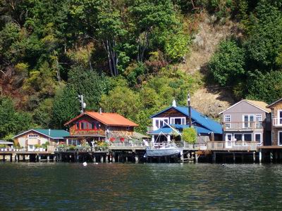
We pulled into Gig Harbor and tied up at the public dock. As we entered the harbor, we saw oil-spill containment booms deployed around some areas, but couldn’t see the cause of the spill. We hiked to a park overlooking the mouth of the harbor, and as we were looking at the view a tug pushed a barge of burned material out into The Narrows. It looked as if it was the blackened remains of a metal building. A man watching the procession explained that a week before a covered dock and 50 yachts (most about 50 feet long) went up in flames. One boat started burning. The flames rose into the gable of the metal roof and spread up and down the dock under the peak, starting other boats on fire. By the time the fire department got there, the roof had collapsed on the yachts, trapping and intensifying the flames and shedding the firefighters’ water. Forty-six boats burned to the waterline and sank. Four were towed away but were a total loss.
Gig Harbor is crowded with boats, mostly pleasure yachts, and lined with expensive real estate. We walked past one vacant “lot” advertised for $950,000. It was a steep rocky embankment, narrowly confined by the road and the water’s edge, perhaps 150 or 200 feet long and 50 feet wide.
 Gig Harbor
After visiting a couple of bookstores, we made our way back to the dock and motored out of the harbor. We anchored for the night in Quartermaster Harbor, a spacious anchorage between Vashon and Maury islands. We couldn’t see Seattle, but we had no doubt we were close to a big city. The jets taking off from Sea-Tac airport flew almost overhead, and there were many of them.
9/13/05. We motored out of the harbor with no wind in the forecast, but once we got into Colvos Passage a three-knot headwind came up. Since we didn’t have far to go, we didn’t have to hurry, the current was favorable (it always flows north in this channel, according to the guidebooks), and Peter hadn’t had any sailing all summer, we raised the sails and I turned the tiller over to him. We slowly sailed close-hauled until the wind abandoned us in the middle of the ferry lane, when we started OB and motored to the dock at Blake Island, a public park.
It must be a busy place in the summer—it’s one of the closest destinations for boaters from Seattle. There’s a replica longhouse where native dances are presented. Several campgrounds are located on the island, which is accessible only by boat. There are many mooring buoys around the shores of the island.
 Blake Island longhouse
At the dock, we were met by the volunteer park hosts, a couple whose 35-foot Island Packet sailboat had “Crescent Lake, Oregon” on her stern. Crescent Lake is high in the Cascades, an unlikely home port for an ocean-cruising yacht. They had sailed on Fern Ridge reservoir, Lacuna’s home water, for many years. After a walk, we motored to the west side of the island and tied up to a mooring buoy.
9/14/05. In a light breeze, we raised the sails and slipped away from the buoy. We had almost seven hours of delightful sailing, with speeds rarely below 2 knots and up to 6.1 knots (over hull speed) under the genoa and main, dodging ferries and a Department of Ecology boat that sped past us three or four times. Low clouds and cold wind kept us in fleece and Goretex. Before 1600, we reached the Des Moines marina, the end of the voyage. It was the best day of sailing of the whole voyage, a fitting way to end.
 Vashon Island (click here for larger image)
I was reluctant to call it over, so I set Lacuna up hove-to under the mainsail while I stripped and stowed as much running rigging as I could. Finally, I knew there was no way to delay further, so I started OB, the first time it had run all day, and pulled into the marina. We pumped out the holding tank and tied up to a slip. I pulled the mainsail off the boom (my plan is to wash it thoroughly--it hasn’t been cleaned since we had it made 13 years ago) and prepped the mast for lowering, undoing the electrical couplings, removing the radar wiring, and coiling the halyards.

Lacuna at Des Moines. Locura, in the background, is 92 feet long; Foxtrot (behind the mast) is more than 70 feet.
9/15/05. Peter and I dropped the mast before breakfast. The sling retrieval went without a hitch and we were on the road by 1000.


The drive home was blessedly uneventful. I was happily reunited with Jill and dogs Calypso and Blue, who were overjoyed to see me. It was bittersweet to see Lacuna in her winter berth in our yard. I gave her bow a hug and rested my cheek against the cool fiberglass for a while before I went into the house.
The voyage totaled 3,464 nautical miles in 706 hours of travel, distance and time well spent. I realized a lifetime’s dream, tested myself in ways I hadn’t before, and enjoyed myself thoroughly. I had experiences that few people would dream of, endured discomfort that few would willingly suffer, and explored places where few would venture. I reached insights about nature that had previously eluded me. I discovered strengths and weaknesses in myself and others. I found new friends whenever I opened myself to them. I found solitude when I wanted it. Now I’m charged with motivation to take on projects at home and at work. Thank you, Lacuna, OB, and Ott, for a wonderful voyage. And thanks most of all to my beloved and infinitely tolerant soul-mate Jill for supporting me and my dream.
May all your winds be fair, your days blessed by nature, and your anchorages snug. Even if your boat is small, may you live your dreams to the fullest.
--Dennis Todd